The Philippines sits on the Pacific Ring of Fire. Earthquakes, typhoons, and flooding are not edge cases — they are recurring operational realities. For engineering teams supporting response and recovery, the first question is almost never technical. It’s logistical: how do you assess damage when the roads are blocked, the bridges are compromised, and the affected area is too dangerous for immediate entry?
The answer, increasingly, is Unmanned Aerial Vehicles (UAV).
In post-disaster environments, the speed and quality of the initial engineering assessment shapes every decision that follows — what gets prioritized for repair, where contractors are mobilized, how resources are allocated. Getting that assessment right, and getting it fast, is not a capability luxury. It is an operational requirement.
This article draws on Planate’s response to the 2025 Cebu earthquake— to explain what drone-based engineering assessment delivers and why it matters particularly in the Indo-Pacific.
What UAVs Actually Change in Post-Disaster Engineering
Drone technology is often discussed in abstract terms — efficiency, innovation, digital transformation. In post-disaster response, the value is far more concrete.
Traditional post-disaster engineering assessment is constrained by the same conditions that make disasters destructive in the first place. Compromised access routes, unstable structures, hazardous debris fields, and active aftershock risk all limit where engineers can safely go and how quickly they can go there.
The result is a lag — sometimes hours, sometimes days — between the moment damage occurs and the moment engineering teams have the data they need to begin prioritizing repairs, scoping recovery work, and allocating resources. In humanitarian response contexts, that lag has direct consequences for life safety. In military and federal infrastructure contexts, it compromises operational readiness.
The data returned by a properly equipped UAV is not merely visual. When operated by engineers who understand what they are looking for, drones return photogrammetric point clouds, georeferenced imagery, topographic models, and thermal data — engineering inputs, not just photographs. That distinction matters enormously when the output is being used to make structural triage decisions.
Cebu: Engineering Assessment After the Earthquake
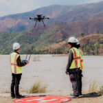
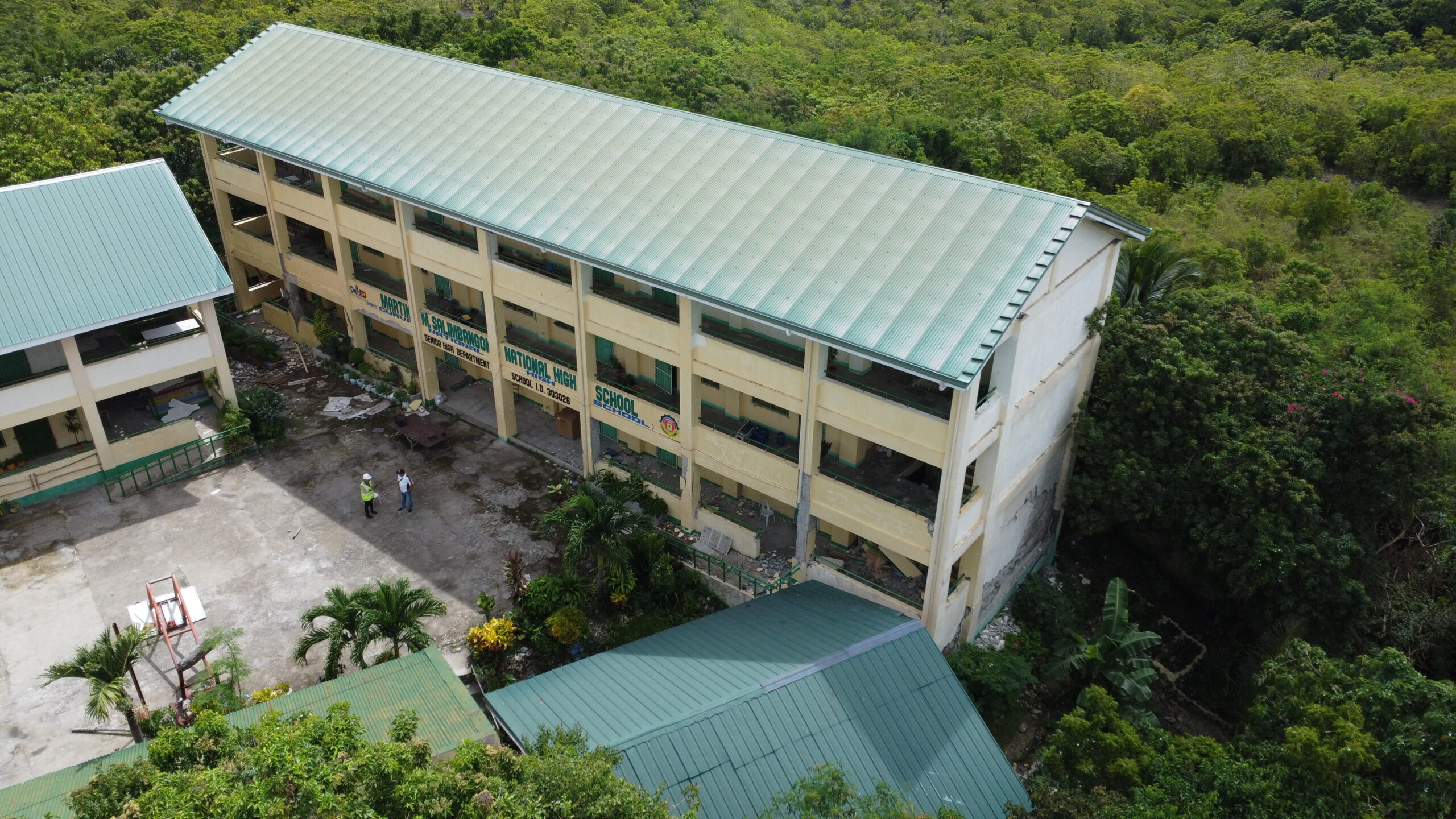
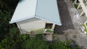
On 30 September 2025, a magnitude 6.9 earthquake struck off the northern coast of Cebu Island — the strongest ever recorded in the region. The event left 79 dead, over 1,200 injured, and an estimated ₱16 billion in damage across the Visayas. In the days that followed, Planate’s team with the support of the U.S. Philippines Society deployed UAV assets to conduct aerial damage assessment and structural imaging across affected areas.
High-resolution photogrammetry allowed teams to identify structural damage indicators — wall failures, foundation displacement, roof collapse patterns — remotely and before ground access was safe. Georeferenced imagery was integrated with GIS mapping to create a damage triage layer: a ranked assessment of which structures required immediate engineering inspection, which required monitoring, and which could be cleared for re-entry.
The practical outcomes were significant. Personnel exposure to unstable structures was reduced. Assessment timelines were compressed. The data package that resulted was immediately actionable for the engineering teams who followed — scoping repair work, preparing cost estimates, and advising recovery decision-makers on sequencing.
What the Cebu deployment demonstrated was not that drones are useful in disaster response. That much is already understood. What it demonstrated is that engineering-grade UAV assessment — conducted by a team with the technical expertise to process and interpret the data — produces outputs that are qualitatively different from standard aerial footage. The difference is the engineering layer.
Watch: Planate Cebu Earthquake Drone Assessment
View the full drone footage from the Cebu earthquake response:
The GTD Capability Stack
Both deployments draw on the same capability platform that Planate’s Global Innovation and Technology Delivery (GTD) division has built across the Indo-Pacific. The components that matter most in post-disaster engineering contexts:
- Drone Mapping and Remote Surveying —Large-area coverage generating topographic data and comprehensive visual assessment before ground teams are deployed. Particularly critical in the first 24–48 hours following a damage event.
- Photogrammetry and 3D Point Cloud Generation —Converting aerial imagery into measurable, georeferenced 3D models used for structural evaluation, volumetric analysis, and site planning. Produces engineering-grade outputs rather than standard imagery.
- GIS Integration and Data Analytics —Georeferencing all collected data for immediate integration into engineering reports, recovery planning documents, and long-term facility monitoring systems.
- LiDAR-Equipped Platforms —Precision scanning of structures, terrain, and infrastructure components in conditions where photogrammetry alone does not provide sufficient resolution for engineering-grade assessment.
- Drone-Powered 3D Scanning —Detailed digital capture of hard-to-access structures — including damaged facades, compromised interiors, and elevated or remote components — supporting both immediate damage assessment and longer-term rehabilitation planning.
- Underwater ROV Integration —For port, pier, and marine infrastructure inspection in environments where aerial assessment reaches its limits. Particularly relevant for Indo-Pacific facilities with significant maritime infrastructure components.
The engineering interpretation layer that sits above these capabilities is what differentiates Planate’s GTD approach. Sensors generate data. Engineers generate assessments. A point cloud is not useful without someone who can read it in the context of structural performance. Georeferenced imagery has limited operational value without someone who can translate visual indicators into engineering judgments that drive repair prioritization and resource allocation.
GTD’s team combines engineering precision, research capability, and regional operational experience. The result is a disaster response capability that begins with technology deployment and ends with engineering-quality deliverables — reports, maps, 3D models, and technical recommendations that decision-makers can act on immediately.
Why the Indo-Pacific Specifically
The Philippines experiences more seismic events per year than almost any country on earth. It also sits in one of the world’s most active typhoon corridors. For infrastructure engineering, this means that resilience planning — the systematic preparation for damage events — is not optional. It is a baseline requirement for any facility that needs to remain operational through and after a disaster.
The Indo-Pacific also hosts some of the most strategically significant U.S. military infrastructure in the world. Naval installations, airfields, logistics hubs, and expeditionary facilities across the region require not just routine maintenance engineering, but active resilience planning that accounts for the realistic probability of damage events — and pre-positioned assessment capability to respond when they occur.
Planate has operated in the Philippines for years through its Subic Bay office, building a sustained regional presence that includes LOGCAP V facility maintenance at Subic Shipyard, GIS and drone survey work supporting federal programs, and an expanding GTD capability specifically calibrated for the region’s operational demands.
What This Means for Infrastructure Owners and Program Managers
For organizations managing federal, defense, or commercial infrastructure in the Indo-Pacific, the practical implication is direct: post-event engineering assessment no longer needs to wait for safe ground access.
Planate’s UAV assets in the region and engineering expertise to interpret the data means the assessment-to-decision cycle compresses from days to hours. That matters across several dimensions:
→ Operational continuity planning — understanding which facilities are operational, which need repair, and which need to be stood down, faster.
→ Insurance and damage documentation — engineering-grade imagery and data that supports claims and reconstruction planning.
→ Repair prioritization and contractor scoping — actionable engineering assessments that allow procurement and mobilization to begin without waiting for full ground access.
→ Long-term resilience investment — 3D models and GIS datasets that become part of the facility’s ongoing documentation and inform future planning.
Planate’s GTD division is continuing to expand its UAV and engineering assessment capability across the Indo-Pacific. If your organization is evaluating drone-based assessment as part of its facility management, emergency response planning, or infrastructure resilience program, we welcome the conversation.
ABOUT PLANATE MANAGEMENT GROUP
Planate Management Group is a Service-Disabled Veteran-Owned Small Business headquartered in Alexandria, Virginia, with offices in the Philippines, Kenya, Ukraine, Taiwan, Thailand, Guam, Papua New Guinea, Florida, and Washington State. The company delivers Architecture & Engineering, Engineering Support Services, and Global Innovation & Technology Delivery capabilities to government, defense, and commercial clients across 25 countries.